
Heavy rains continued to lash several parts of Kerala on Thursday, leading to waterlogging in the low-lying areas of major cities, including Thiruvananthapuram, Kochi and Thrissur.

The India Meteorological Department (IMD) predicted that cold wave to severe cold wave conditions are very likely to continue in northwest India over the next three days and abate thereafter.

India is likely to see above-normal rainfall in the four-month monsoon season (June to September) with cumulative rainfall rainfall estimated at 106 percent of the long-period average (87 cm), he said.

The cold wave days in December too are expected to be 'below-normal' this year.

The weather office has issued a forecast of heavy to very heavy rains at isolated places in several districts of Gujarat over the next one week.

Spurred by cyclone Remal, the southwest monsoon set in over the Kerala coast and parts of the northeast on Thursday, a day earlier than forecast by the weather office.

The monsoon onset over Kerala marks the commencement of the four-month rainfall season in the country.

Some of the worst-affected areas include Manyata Tech Park, BTM Layout, Ejipura Junction, HSR Layout 5th and 6th sectors and Silk Board Junction.

To ensure immediate cooling of the body, the hospital has set up a first-of-its-kind heatstroke unit.

A three-hour heavy downpour accompanied by a dust storm hit Delhi-NCR early morning on Friday, causing flight delays and traffic disruptions as seven people were killed in rain-related incidents across north India.

Sri Lanka meteorological department predicts better weather in coming days

As weather patterns grow more unpredictable due to climate crisis, India is taking a giant leap with "Mission Mausam" to improve weather understanding and forecasting through expanded observation networks, better modeling and advanced tools like AI and machine learning.

India recorded around 16 per cent more rainfall than normal in August, with rainfall over Northwest India recorded at 253.9 mm, the second highest in August since 2001, the India Meteorological Department (IMD) said on Saturday.

Satellite imagery showed a dense elongated band of fog stretching from Punjab to the northeast.

Houses in low lying areas of Kerala were flooded in the heavy rains, while the accompanying strong winds uprooted trees, damaged homes and caused power disruptions, throwing normal way of life into disarray across the state.

Incessant rains with intermittent spells of moderate to heavy showers since Friday morning have slowed down public transport services and traffic in Mumbai.

The rains after arriving over Kerala will quickly cover Tamil Nadu and Karnataka, but then might slacken a bit, which could delay its arrival over Northwest India.

Normally, the southwest monsoon makes its onset over Kerala by June 1 and covers the entire country by July 8. It starts retreating from northwest India around September 17 and withdraws completely by October 15.

Rijiju, who was removed as law minister on Thursday, refused to answer questions about his previous ministry contending that they were no longer relevant and that he looked forward to serve in the Earth Sciences Ministry.

The maximum temperature on Saturday settled at 18.1 degrees Celsius, two notches below the season's average, and the minimum was recorded at 3.6 degrees Celsius, four notches below the season's average, the IMD said.

Senior IMD scientist R K Jenamani said the monsoon covered south and central Arabian Sea, entire Kerala, parts of Karnataka and Tamil Nadu between May 31 and June 7.

A 22-year-old youth and a person with disability died, while at least 11 were injured, in separate rain-related incidents in the national capital on Wednesday evening. The incidents occurred amid sudden changes in weather in Delhi, as a rainy storm marked by hail wrecked havoc across the city, throwing traffic out of gear as far as Delhi-Noida, Delhi-Ghaziabad, and Delhi-Gurugram roads and uprooting several trees.

Climate scientists warn that climate change is intensifying heatwaves in India, with the cooling effects of La Nia potentially becoming less effective in a warmer future. The India Meteorological Department (IMD) predicts an early summer with above-normal temperatures and intense heatwave spells, following an unusually dry winter and the warmest February since 1901. Experts emphasize the role of human-caused climate change, along with natural climate drivers like El Nio and La Nia, in shaping weather patterns. While La Nia typically brings cooler temperatures, scientists suggest that under climate change, its ability to mitigate heatwaves may be diminished.

It expects rainfall to be about 106 per cent of the long period average, aided by La Nia conditions anticipated to play a role in the second half of the monsoon season.

India has received 20 per cent less rainfall since the start of the monsoon period on June 1, with the rain-bearing system making no significant progress between June 12 and 18, according to the India Meteorological Department (IMD).

A strong dust storm and gusty winds followed by rain hit Delhi-NCR on Friday evening, causing trees to be uprooted in several parts and leading to traffic congestion. Thunderstorms caused power disruptions in several parts of the city, primarily due to trees and branches falling on electricity cables. The India Meteorological Department (IMD) has issued an orange alert, recommending people stay indoors and avoid unnecessary travel.

Delhi's primary weather station, the Safdarjung Observatory, registered a maximum temperature of 40.4 degrees Celsius, four notches higher than normal.

The recent helicopter crash near Kedarnath, in which seven lives were lost, has proven yet again that aviation regulatory authorities have not learnt lessons from similar air mishaps in the challenging Kedar valley and have done little to improve flying conditions.

In a notice, IMD said, 'VSCS BIPARJOY over east-central Arabian Sea, lay centred at 0530hrs IST of 08th June, near lat 13.9N & long 66.0E, about 860km west-southwest of Goa, 910km southwest of Mumbai, would intensify further & move north-northwestwards.'

Strong demand for cultural and spiritual hubs is expected for destinations like Varanasi, Kolkata during Durga Puja, and Pushkar for the camel fair, besides leisure destinations like Goa, Udaipur, Jaipur and Coorg.

The India meteorological department predicted mainly clear skies with heatwave conditions in many parts of Delhi and severe heat wave conditions in other areas.

The IMD has predicted moderate showers in Mumbai on Tuesday and high intensity rains in neighbouring Raigad.
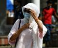
India experienced its second-hottest quarter from June to August this year since 1970, with over one-third of the country's population enduring at least seven days of dangerous heat, according to a new report by a United States-based group of climate scientists and communicators.

A total of 33 teams have been earmarked by the National Disaster Response Force (NDRF) to undertake relief and rescue operations in Gujarat and Maharashtra ahead of the expected landfall of cyclone 'Biparjoy' near the Jakhau port in Kutch district, officials said on Wednesday.

A cold wave has intensified in most parts of north India, with temperatures in the Kashmir Valley dipping below freezing point. The national capital saw a brief respite from the bitter cold during the day, but cold conditions persisted in parts of Rajasthan and Himachal Pradesh. The weather department has issued a yellow warning for cold wave, ground frost and dense fog for some places in Himachal Pradesh. There is a possibility of rain and snowfall in parts of northwest India later in the week.

The IMD director said, the cyclonic storm Tauktae in the Arabian sea is moving away from the Kerala coast and is now approaching the Karnataka coast.

The very severe cyclonic storm was located over the east-central Arabian Sea located 840-kilometer west-southwest of Goa and 870 km west-southwest of Mumbai at 11.30 pm on June 8, the IMD said.

Monsoons have had limited effect on market returns for a given year, report Sachin Mampatta and Sundar Sethuraman.

The mean maximum temperature for the month of March was 28.2 degrees Celsius in 2020 and 2019. It was 32.8 degrees Celsius in 2018; 30.7 degrees Celsius in 2017 and 31.5 degrees Celsius in 2016, according to the India Meteorological Department data.

An earthquake of moderate intensity, measuring 5.2 on the Richter scale, jolted India-Bangladesh border in Karimganj on Saturday.
